Mullerthal Trail 
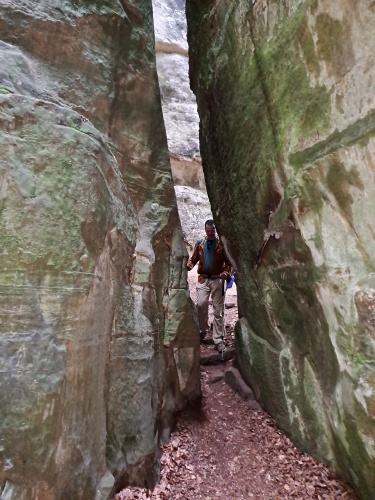
The Mullerthal Trail runs through a small European country that many people often forget: Luxembourg. Smaller than the state of Rhode Island and boasting of only about 650,000 residents, there’s a reason it’s often one of the forgotten countries of Europe. But you would be missing out on medieval castles and gorgeous rocky cliffs and canyons if you skip out. It’s a surprisingly diverse country for as small as it is.
The full, official name of the country is Grand Duchy of Luxembourg, and who can’t love a country with the term Grand Duchy in it the title? The official language is perhaps a language you didn’t even realize existed: Luxembourgish. However, squeezed between Belgium and Germany, both French and German are also official national languages and in common use. Although not an official language, Dutch is quite common as well. For us English-speakers, you’ll find very little signage in English, although most (not all, however!) people we bumped into could speak English as well. Knowing French, German or Dutch is a big advantage although not absolutely essential.
Fortunately for me, my hiking companion on this trip is Karolina, a native from Poland but who has lived for years in the Netherlands and speaks fluent Dutch. She also studied French in school and can get by in that language and, although she’s never studied German, claims that Dutch and German are very similar and often recognizes a lot of words in that language as well.
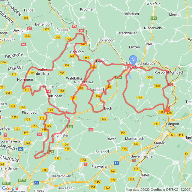
Being so close to where Karolina lives—just over a five-hour drive away—she drove her vehicle to the starting point of the trail in Echternach. Having a self-supported car support was very useful, albeit not strictly necessary. The main route is divided into three, connecting loops, and there were four additional connected side-loops that can be used to extend the hike. For this website, of course, I wanted to link the loops together into the longest route I could, which is precisely what I did.
The Real Life Route vs. the Virtual Route
Because we had access to a vehicle, we hiked it in a different order than actually presented on this website. In real life, we did each loop, one at a time. Started with Loop 1, then did Loop 2, then Loop 3 and finally Loop D. We also did Loops A, B and C, but those were more of “extensions” to loops 2 and 3 while Loop D was more-or-less a complete full-sized loop in its own right. The point is, however, the virtual route presented here removes all the driving we did. Each time we completed a loop, we were never away from the car for more than three days at the longest. We could resupply and cache extra supplies in the vehicle knowing we’d be back in two or three days. It meant we could drive into bigger towns to buy food or find lodging rather than relying on smaller towns for a resupply.
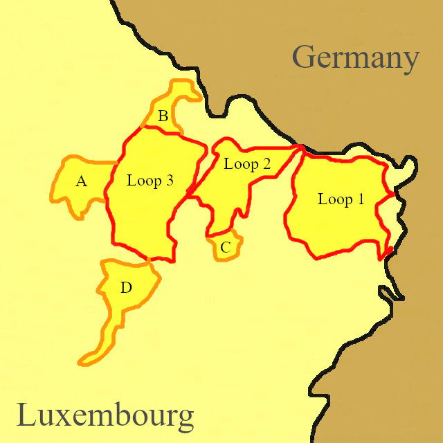
So anyhow, in real life, we hiked, in order:
- Loop 1
- Loop 2 (which was merged with Loop C)
- Loop 3 (which was merged with Loops A and B, in that order)
- Loop D
In the virtual walk (or if you ever want to hike this entire distance without a support vehicle), this is the order we use:
- Loop 1
- Loop 2 (northern half)
- Loop 3 (southeast portion)
- Loop D
- Loop 3 (southwest portion)
- Loop A
- Loop 3 (northwest portion)
- Loop B
- Loop 3 (northeast portion)
- Loop 2 (southwest portion)
- Loop C
- Loop 2 (southeast portion)
It looks a bit more complex, but this covers the entire route from end-to-end in a set of continuous footsteps.
In any case, that isn’t really very important. I just wanted to be upfront about our actual route vs. this virtual route in case you happen to notice discrepancies in the photos where a sunny day suddenly turns cloudy or a morning suddenly changes to evening. There are photos where it looks like it rained during the night (which it did), but the night it rained turns out to be further up the virtual trail.
| Stage Name | Length (miles) | Position (miles) | |
|---|---|---|---|
| 1. | Echternach to Rosport | 5.4 | 0.0 → 5.4 |
| 2. | Rosport to Moersdorf | 7.5 | 5.4 → 12.9 |
| 3. | Moersdorf to Herborn | 6.6 | 12.9 → 19.5 |
| 4. | Herborn to Echternach | 8.1 | 19.5 → 27.6 |
| 5. | Echternach to Mullerthal | 10.4 | 27.6 → 38.0 |
| 6. | Mullerthal to Blumenthal | 6.0 | 38.0 → 44.0 |
| 7. | Blumenthal to Junglinster | 4.2 | 44.0 → 48.2 |
| 8. | Junglinster to Bourglinster | 9.0 | 48.2 → 57.2 |
| 9. | Bourglinster to Blumenthal | 7.6 | 57.2 → 64.8 |
| 10. | Blumenthal to Larochette | 5.8 | 64.8 → 70.6 |
| 11. | Larochette to Nommern | 7.3 | 70.6 → 77.9 |
| 12. | Nommern to Medernach | 5.1 | 77.9 → 83.0 |
| 13. | Medernach to Berens | 4.4 | 83.0 → 87.4 |
| 14. | Berens to Beaufort | 7.4 | 87.4 → 94.8 |
| 15. | Beaufort to Mullerthal | 7.1 | 94.8 → 101.9 |
| 16. | Mullerthal to Hersberg | 5.9 | 101.9 → 107.8 |
| 17. | Hersberg to Bech | 5.1 | 107.8 → 112.9 |
| 18. | Bech to Echternach | 9.2 | 112.9 → 122.1 |
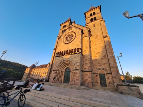
Basilica of Echternach
Moersdorf, Luxembourg
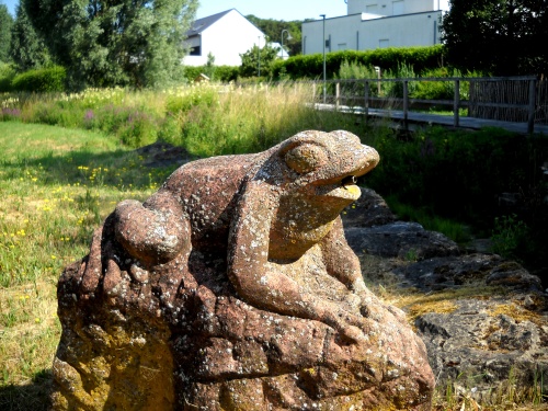
Frog statue
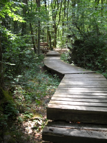
Boardwalks
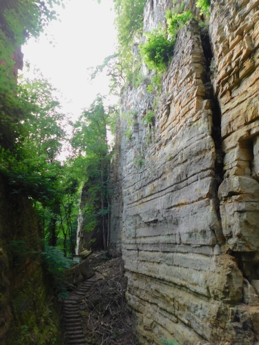
Wolf’s Gorge
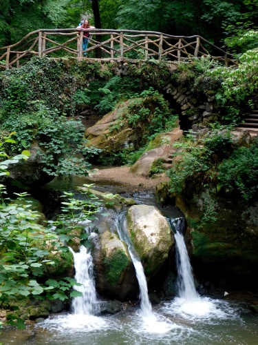
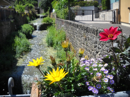
Schéissendëmpel Waterfall and Bridge
Downtown Blumenthal
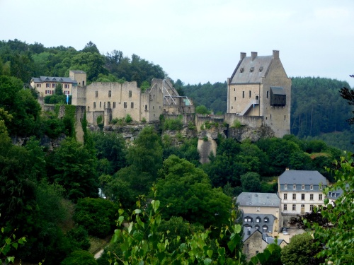
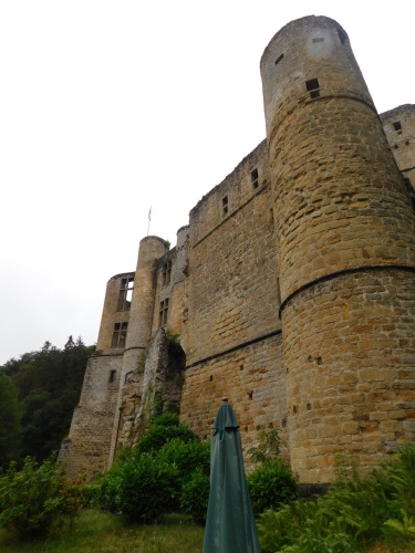
Larochette Castle
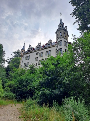
Château de Meysembourg
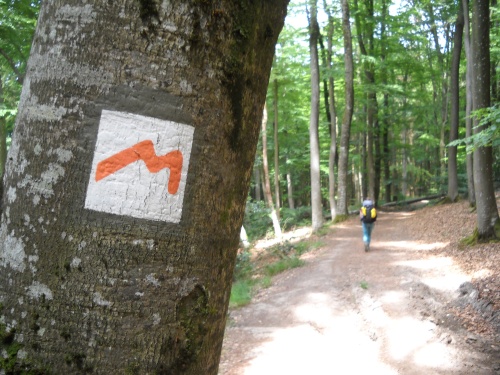
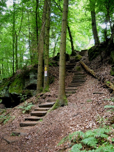
Mullerthal Trail Waymark
Beaufort Castle
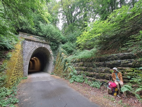
Old Railroad Tunnel